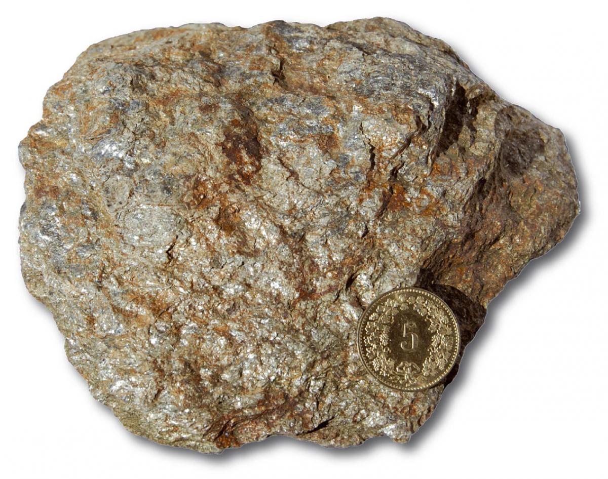
The rocks that can be observed here belong to the base of the rocks of Monte Caslano and constitute the southernmost outcrop of Giumello Gneiss. Towards the north, this formation extends as far as Mottone di Giumello (in the upper Morobbia Valley) where it reaches its full development. It is undoubtedly one of the oldest rocks of the Sottoceneri.
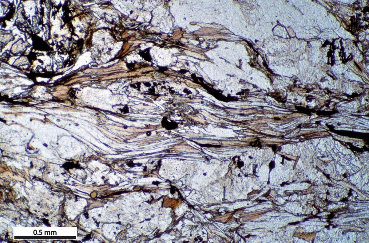
The silvery shine comes from the alignment of the lamellar crystals of white mica (muscovite), which gives the rock its characteristic schistosity and the consequent flaking along undulating planes. Dark mica (biotite), quartz and feldspar are the other minerals that make up the rock. The reddish colours, on the other hand, are a consequence of exposure to atmospheric agents.
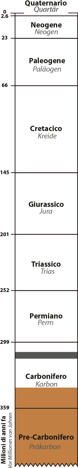
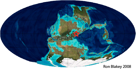
The Giumello Gneiss is a silicate rock rich in aluminium and derives from a clayey sediment more than 500 million years old. However, its current appearance was acquired only 340 million years ago, in the Lower Carboniferous period, during the formation of a mountain ridge located near the equator: the variscan chain.
As a result of this process, temperatures of around 600 °C and pressures of around 8,000 bar transformed the rock, resulting, among other things, in the preferred orientation of the mica crystals.
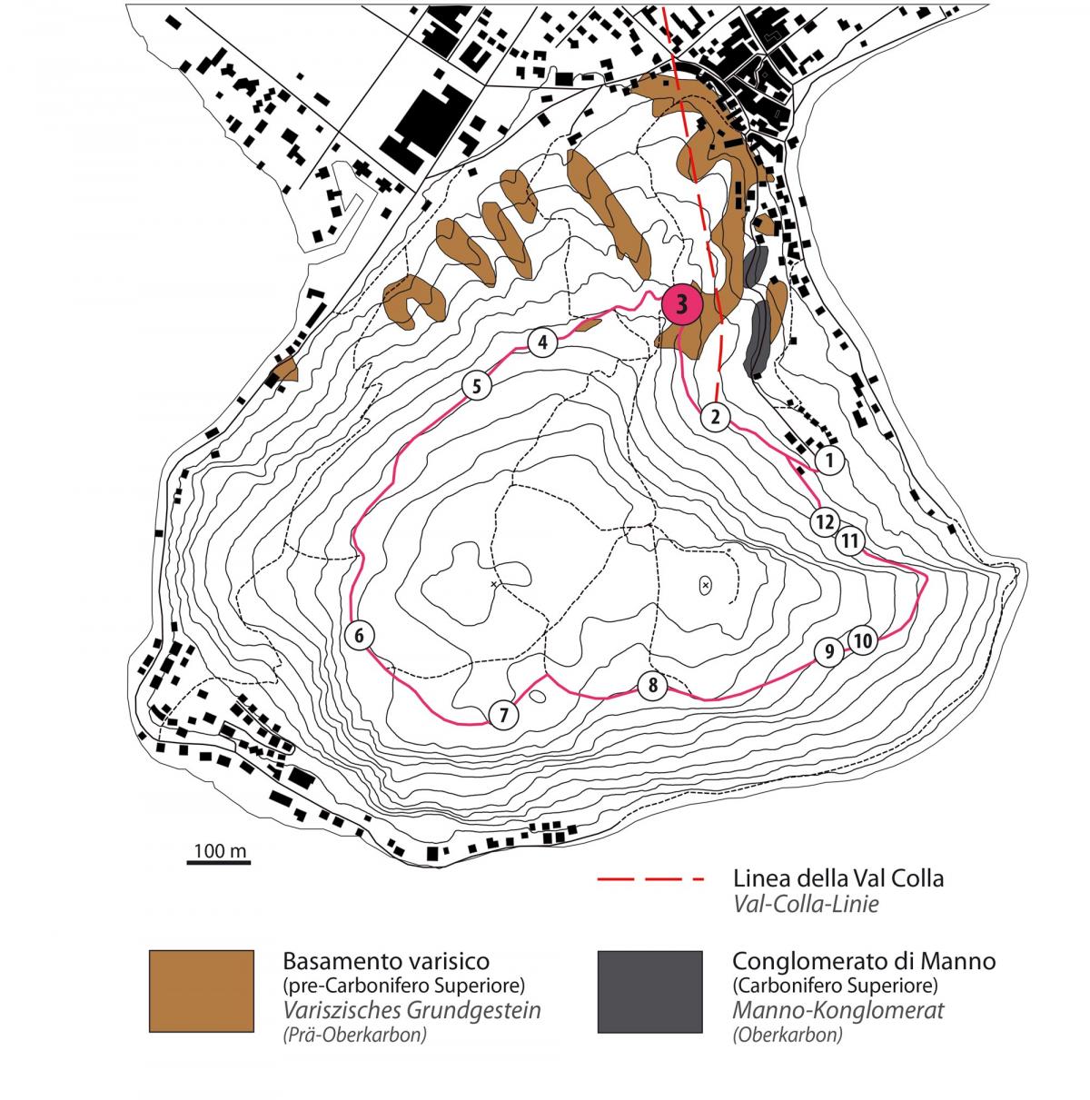
In our region, the variscan chain was soon flattened by erosion. The resulting debris formed the sands and gravel of the Manno Conglomerate (Upper Carboniferous, 310 million years ago), which can be seen in the quarries of the same name surrounding Lugano but can also be seen on Monte Caslano, although only in a few places to the northeast of the path.
The variscan base of Monte Caslano also bears witness to the southern end of the Val Colla Line, an important fault that then develops towards the northeast as far as Monte Gazzirola and beyond. The Val Colla Line cuts through the variscan base that forms the northern slope of Monte Caslano but does not continue southwards through the rocks of the mountain formed from the Permian period onwards, thus testifying to its carboniferous age.